This post is also available in:

![]() Čeština
Čeština
I’ve just come back from a hiking trip to Lake Garda and I’m still so excited about it that I had to write this post right away. You know, before the next trips happen and the details start getting blurry.

What surprised me most was how varied the hikes around Lake Garda are. There are trails for nearly every level, from easy walks with beautiful views to more demanding hikes that’ll make your legs question your life choices a little.
And the views? Lake Garda, the largest lake in Italy, is already stunning from the shore, but seeing it from above is something else. The blue water, the tiny towns below, and the Garda Mountains all around. It’s just so, so beautiful.
Another thing I loved was how peaceful many of the trails felt. In nice weather, the shores of Lake Garda can get quite busy. But once you head up into the mountains, the crowds thin out fast.
Before we jump into the specific hikes, let’s clear up a few practical details first:
Table of Contents
What to Know Before You Go Hiking at Lake Garda
Do you need hiking boots for Lake Garda hikes?
You don’t need hiking boots for most Lake Garda hikes, but wear at least sneakers with a good grip. Many trails are rocky, and if there’s a sudden shower, they can get slippery.
Is hiking around Lake Garda beginner-friendly?
Yes, hiking around Lake Garda can be beginner-friendly. Many trails are manageable even if you don’t hike often.
I’ll include the key details under each hike, so you can choose the right one for you.
When’s the best time to hike around Lake Garda?
The best time to hike around Lake Garda is generally from April to October, depending on the current weather. I visited at the end of May and found it perfect. For the time of day, mornings worked best for all the hikes I did, also because of parking.
Are the hiking trails well marked?
Lake Garda hiking trails are mostly well marked, but don’t rely on signs alone. Download offline maps in advance. Mobile signal is available in most places, but not everywhere.
I used Mapy.com, which seems to have the trails marked better than Google Maps. I marked each of the trails below, so you can save them to your phone before heading out.
Can you hike around Lake Garda without a car?
Yes, you can. Your patience might be tested a little by Italian public transport, but it shouldn’t be too bad. I didn’t try the public buses myself, but below I list the connections that were available at the time of my research. Two of these hikes are not manageable by bus.
For bus connections, the Garda Trentino local mobility website seems to be the best place to check current timetables.
Best base for hiking Lake Garda?
The hikes I list here are mostly around the northern half of Lake Garda. So, if hiking is your priority, I suggest staying in one of the northern towns.
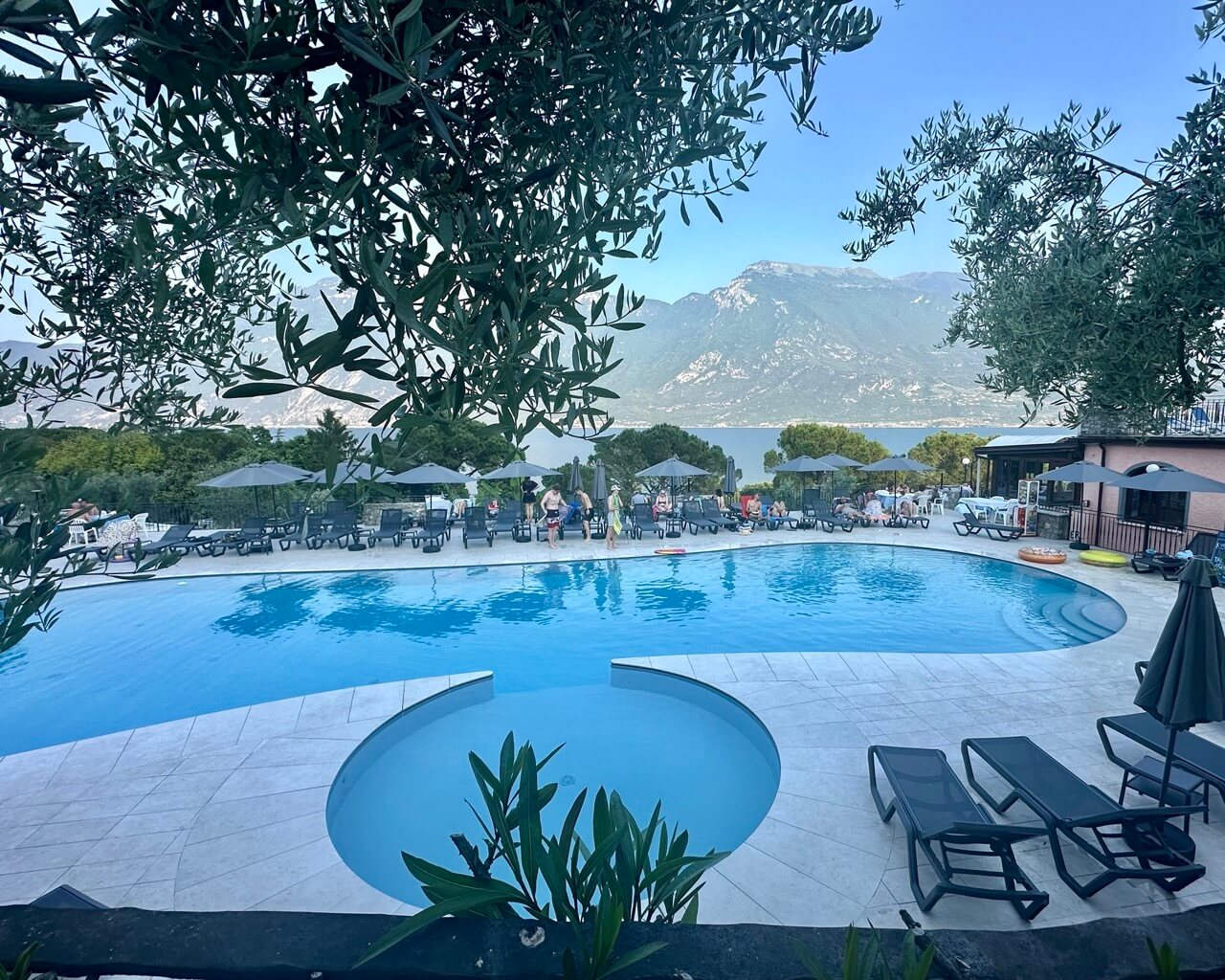
I stayed in Limone sul Garda, and it was the best. There’s a lovely campsite with a pool right by the lakeshore called Camping Park Garda.
Riva del Garda and Malcesine would be good options too.
Monte Baldo Hike: Cima delle Pozzette
Type of hike: Round trip (same way up and down)
Difficulty level: Moderate
Duration: 3–4 hours
Altitude gain: 450 meters / 1,475 feet
Distance: 8 kilometers / 5 miles
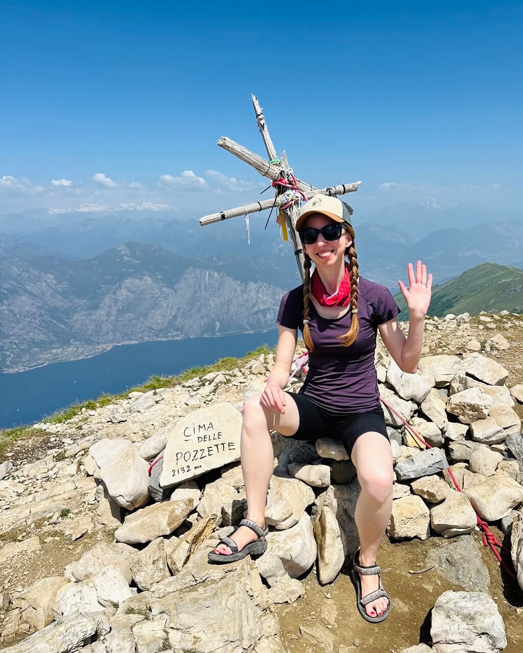
Highest point: Cima delle Pozzette 2,132 meters / 6,995 feet
Start and end point: Malcesine Monte Baldo cable car (Via Navene Vecchia 12, Malcesine)
Best for: Beautiful views of the lake, a short but sporty hike
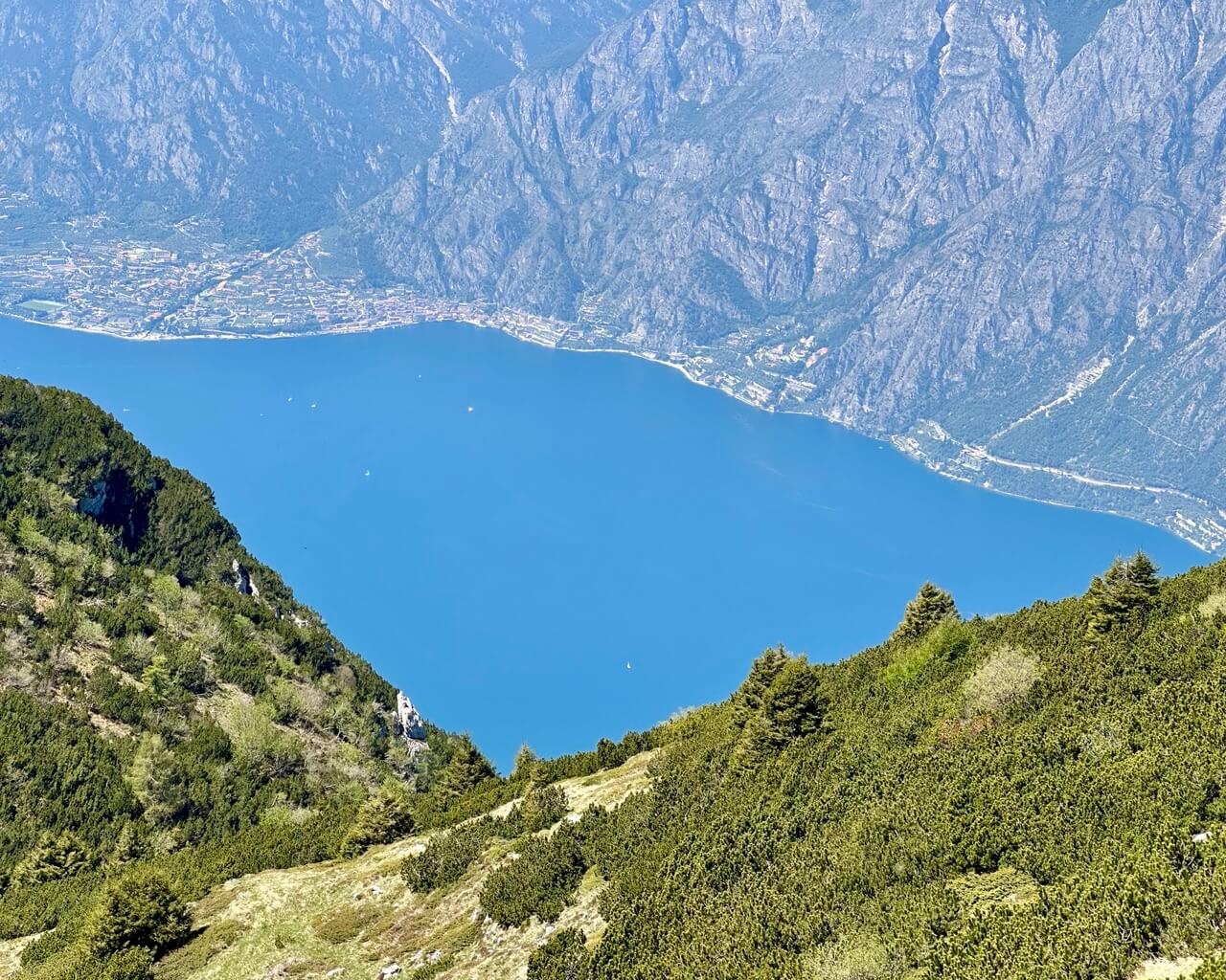
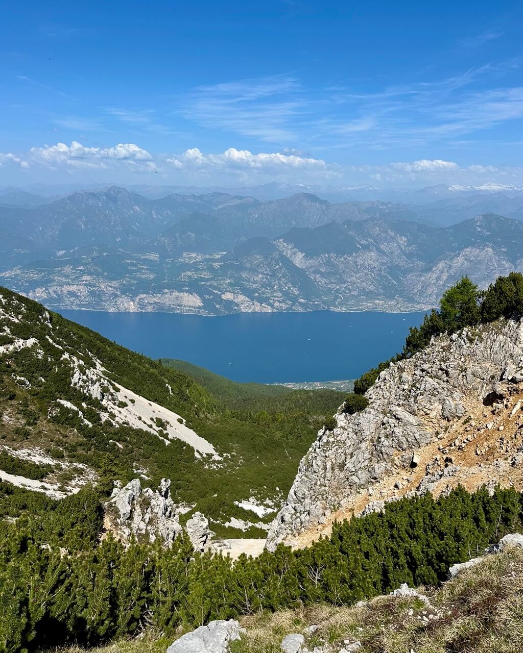
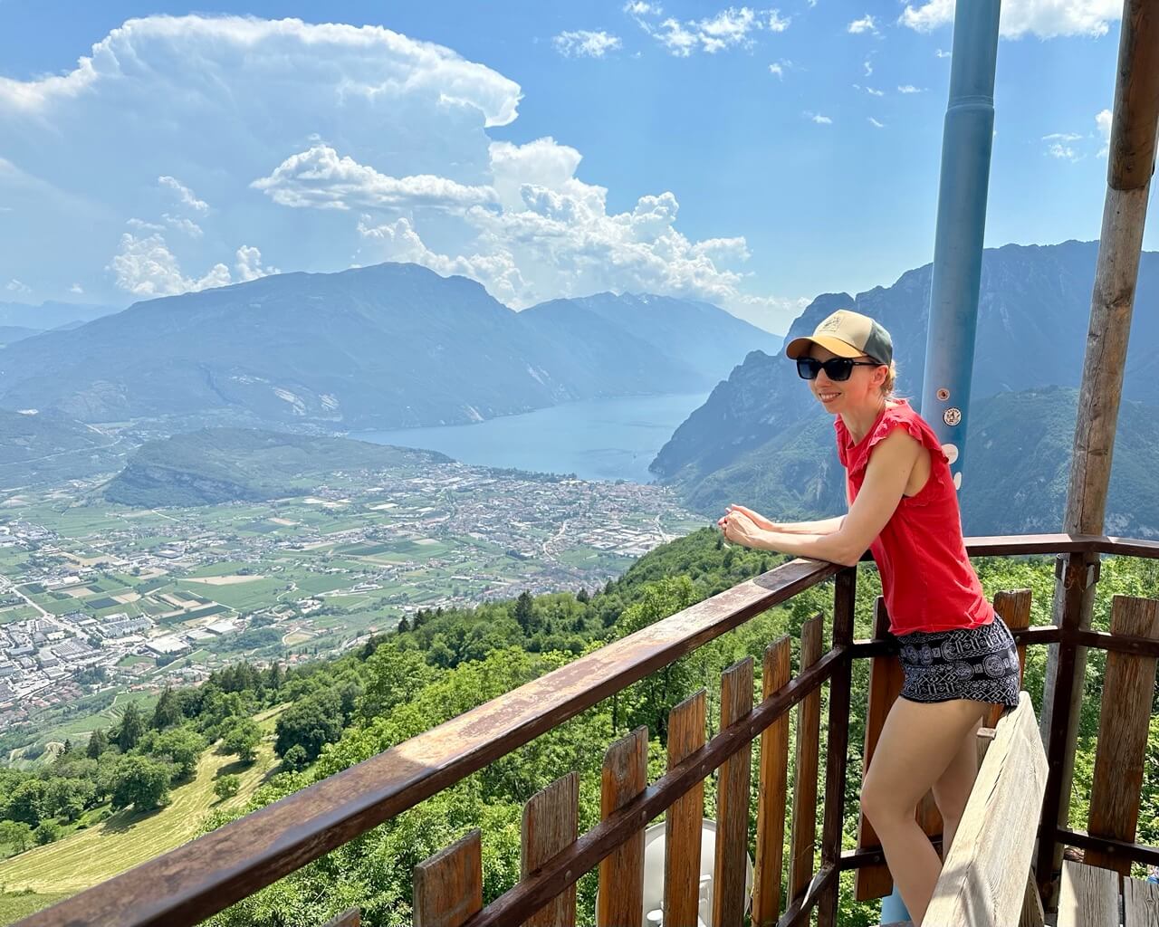
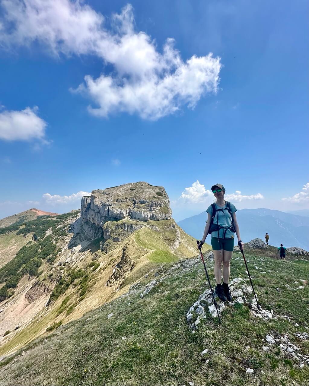
I’m starting with this Monte Baldo hike because it’s one of the first trails many people look into when planning a hiking trip around Lake Garda. And for good reason: it’s easy to access from Malcesine by cable car, and the views start almost immediately.
That doesn’t mean the hike itself is effortless. The trail is rocky and exposed, but it’s relatively short and very rewarding. You’ll get stunning views of Lake Garda and the mountains around it almost the whole way.
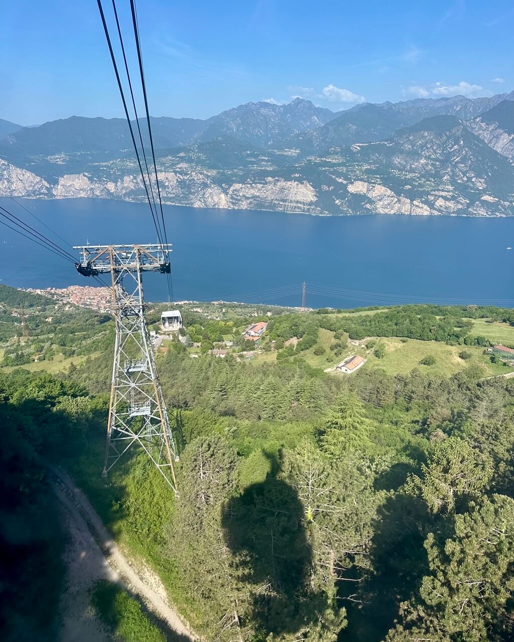
For this hike, you’ll take a cable car both up and down. Your start and end point is Malcesine, a lovely town on the eastern shore of Lake Garda.
Taking the Monte Baldo Cable Car
You can find all current information about the cable car on the official Monte Baldo cable car website. In 2026, the return ticket cost €28 per person.
The ride consists of two cable cars. You need to transfer at San Michele, but almost everyone does the same, so it’s easy and smooth.
The upper cable car slowly rotates, which means everyone gets a beautiful view of the lake on the way up. Keep your ticket for the transfer and for the way back down.
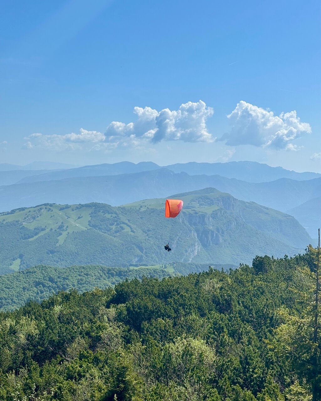
The cable car can get busy because it’s used not just by hikers, but also by mountain bikers and paragliders. Go as early as you can. It opens at 8 a.m., and even then, you should still count on some waiting time.
If possible, buy your ticket online in advance on the link above.
There’s a paid parking lot right by the cable car station, or you can use any other one in Malcesine. If you come by bus, the closest bus stop is Malcesine – Autostazione.
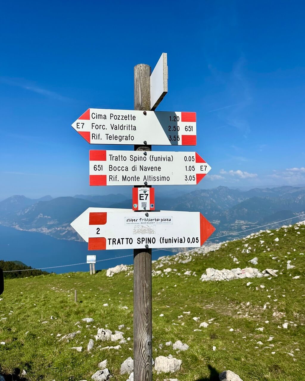
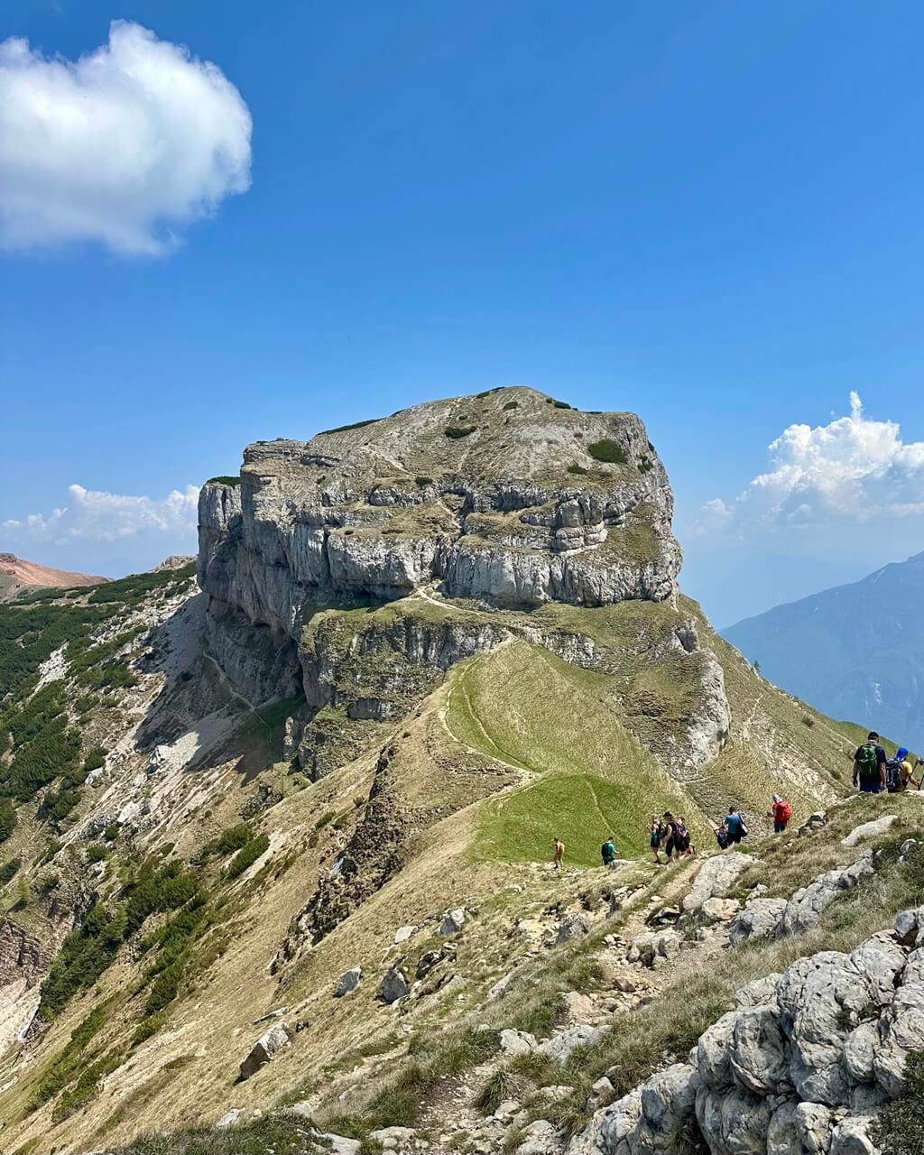
Hiking to Cima delle Pozzette
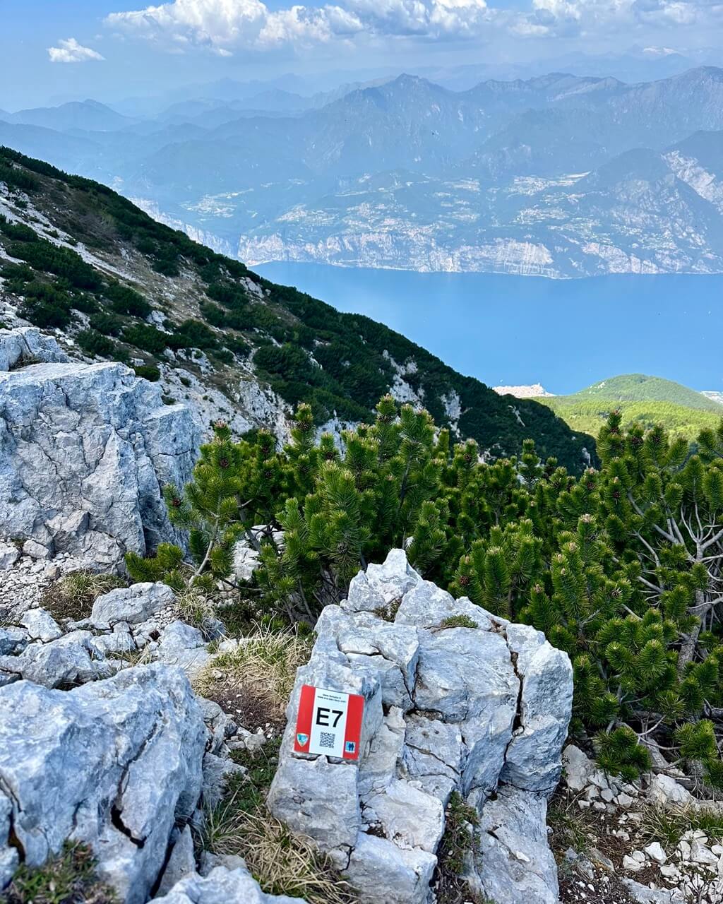
Once you get off the cable car, follow the red-marked trail no. 651 (or part of E7) toward Cima delle Pozzette. You’ll stay on this trail the whole way.
At first, you’ll walk slightly downhill to Passo Tratto Spino. From there, the climbing part starts.
The trail is mostly narrow and rocky. I walked it in trekking sandals and, well, let’s just say I do not recommend that at all. I had to be extra careful, so proper sneakers with good grip would have been much better.
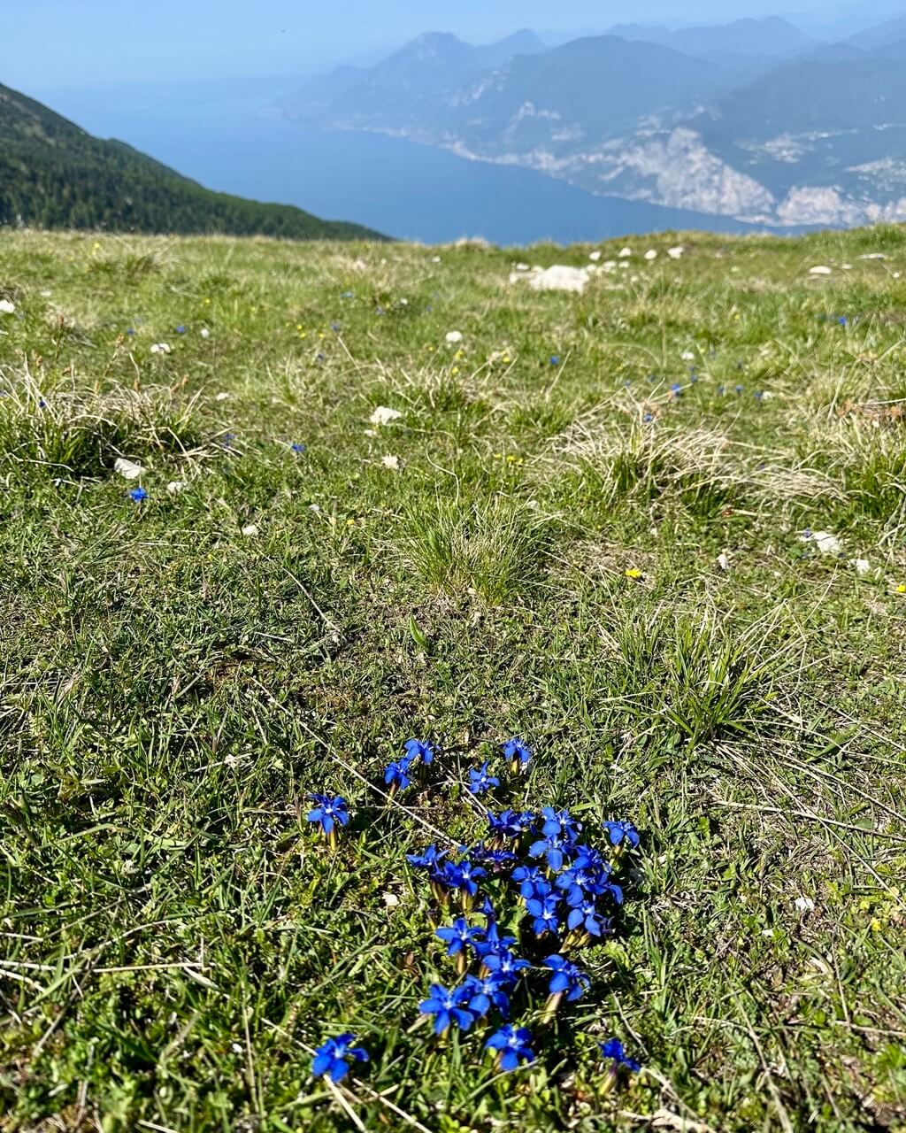
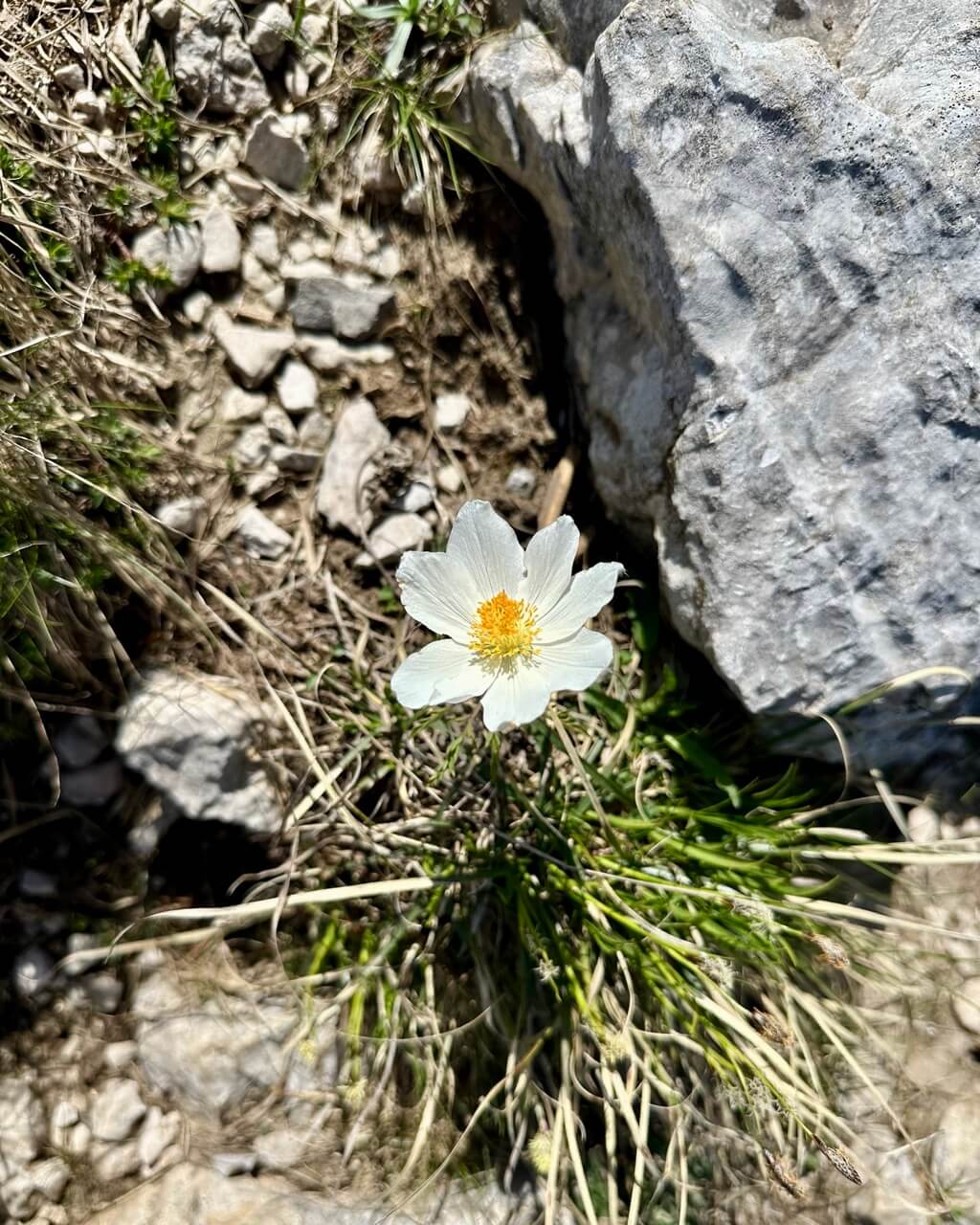
The whole hike is quite exposed, with no real tree cover. You’ll mostly see low coniferous trees that are more like bushes, so bring sun protection.
Before you reach the top at Cima delle Pozzette, at 2,132 meters, there are a few exposed sections. If you struggle with vertigo, you may not love those parts.
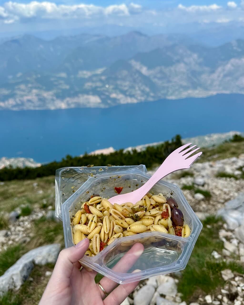
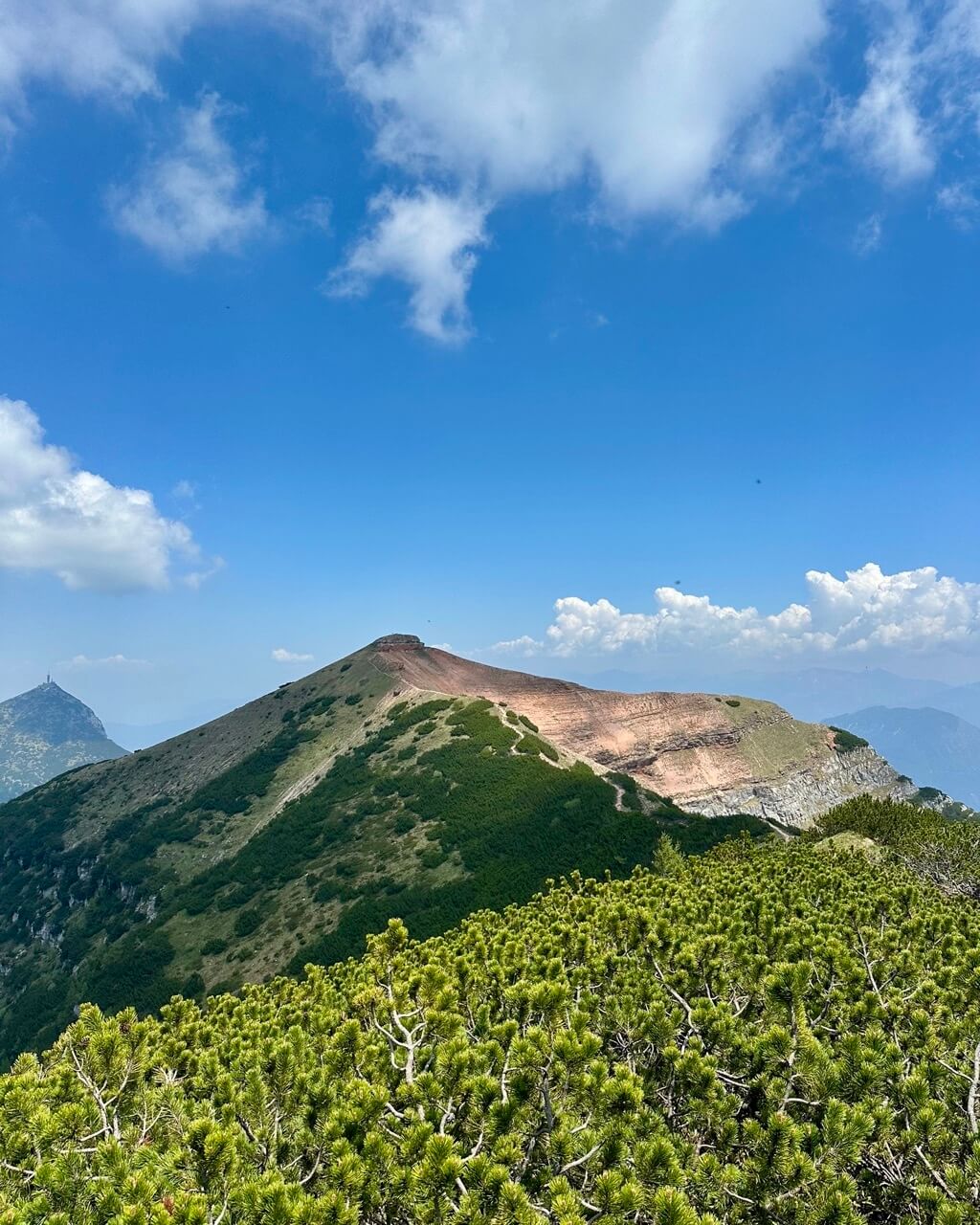
That said, the views are incredible. On your way up, Lake Garda will be on your right-hand side the whole time. Once you reach the top, sit down, take it all in, and ideally pull out a snack or two. This is not the place to rush.
The way down is the same as the way up. Just take it slowly, especially on the rocky sections, and follow the trail back to the cable car.
Once you’re back down in Malcesine, reward yourself properly. A nice meal is ideal, but at the very least, get a gelato. You’ve earned it!
Monte Altissimo di Nago
Type of hike: Circular
Difficulty level: Moderate to advanced
Duration: 4 hours
Altitude gain: 470 meters / 1,542 feet
Distance: 8.2 kilometers / 5.1 miles
Highest point: Monte Altissimo di Nago, 2,079 meters / 6,821 feet
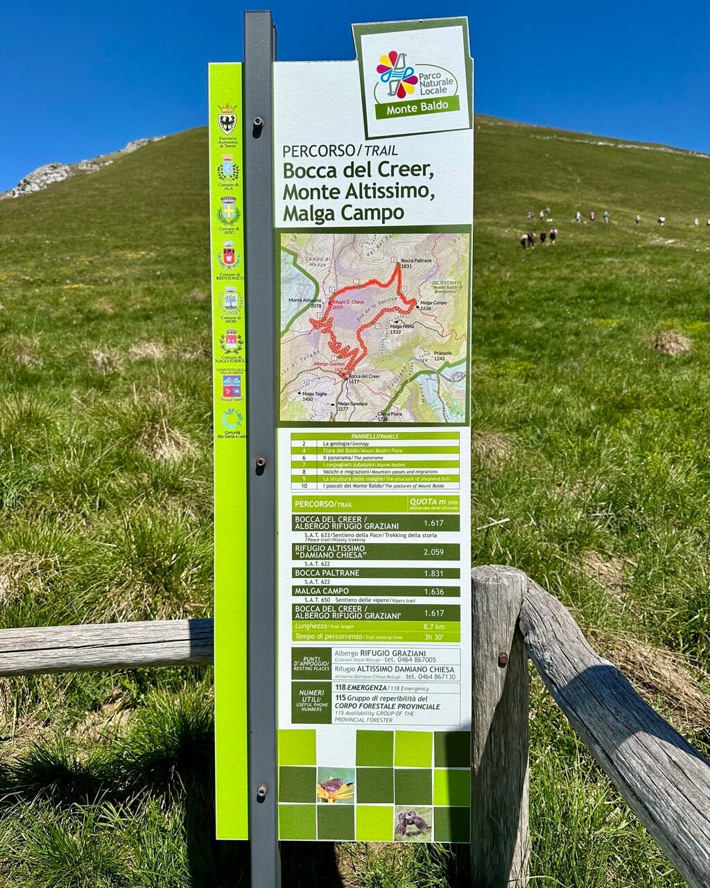
Start and end point: Bocca del Creer
Best for: Incredible views of the lake and delicious food at a mountain hut
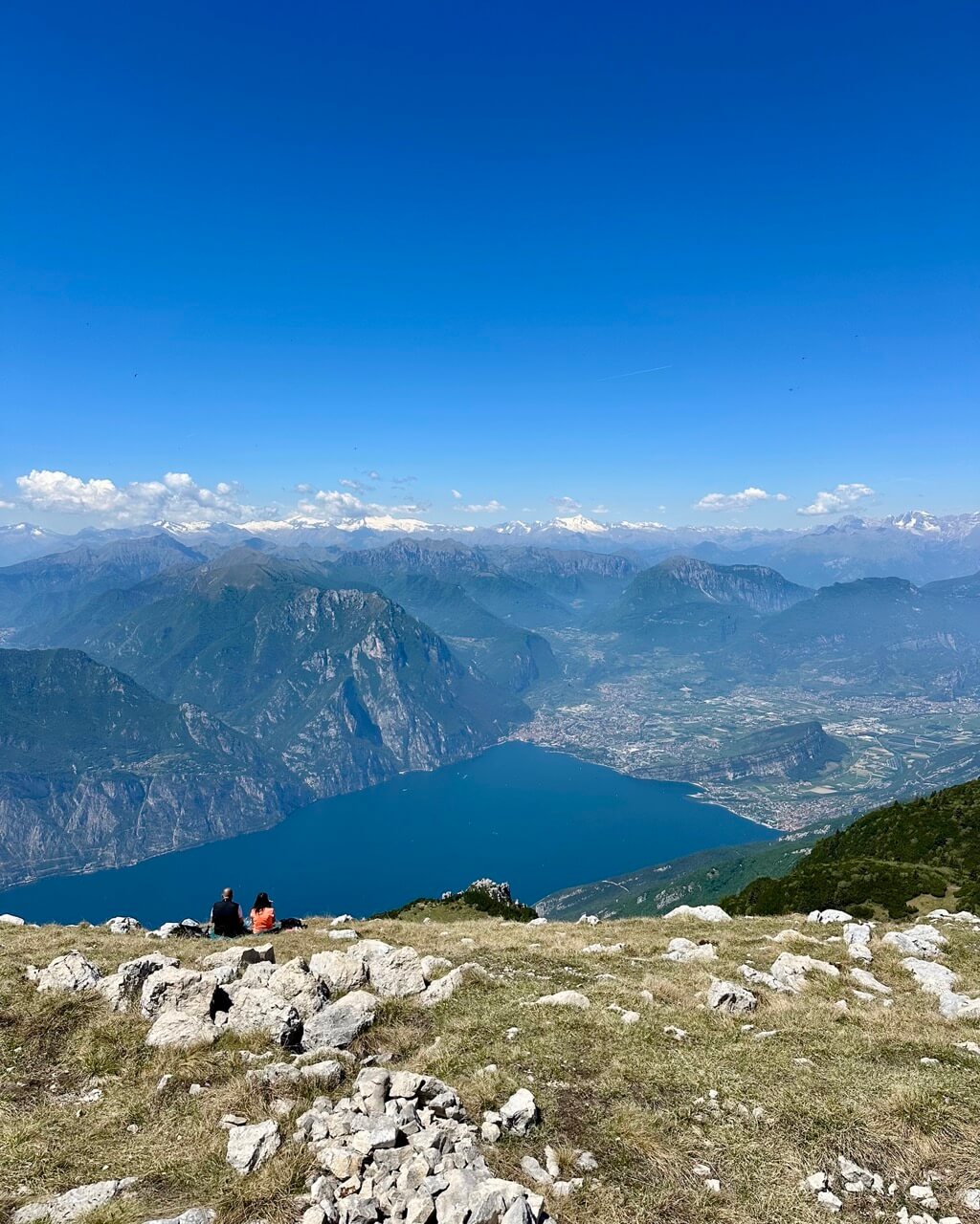
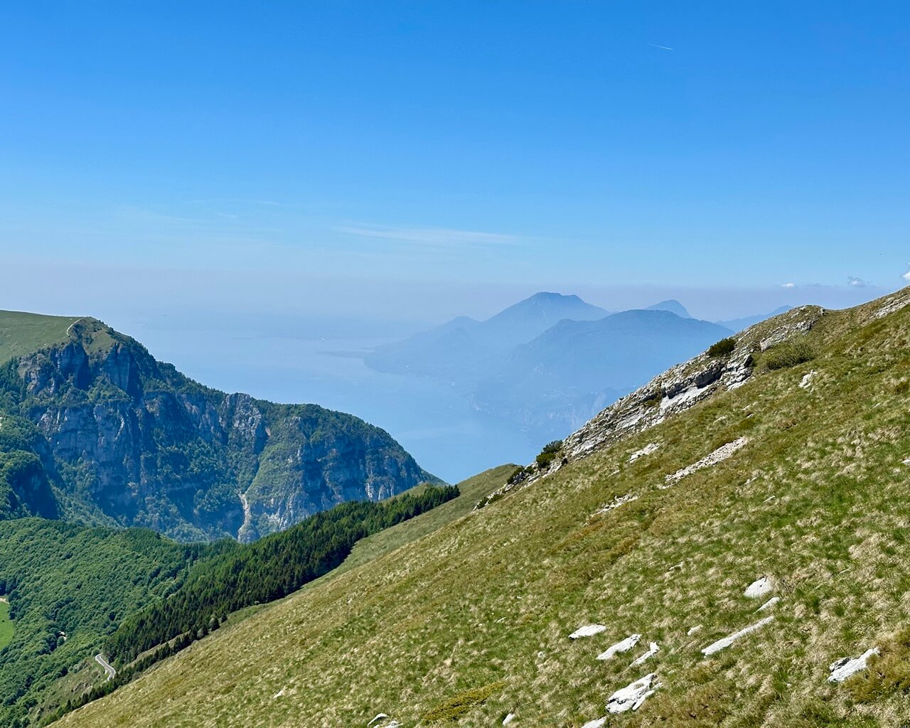
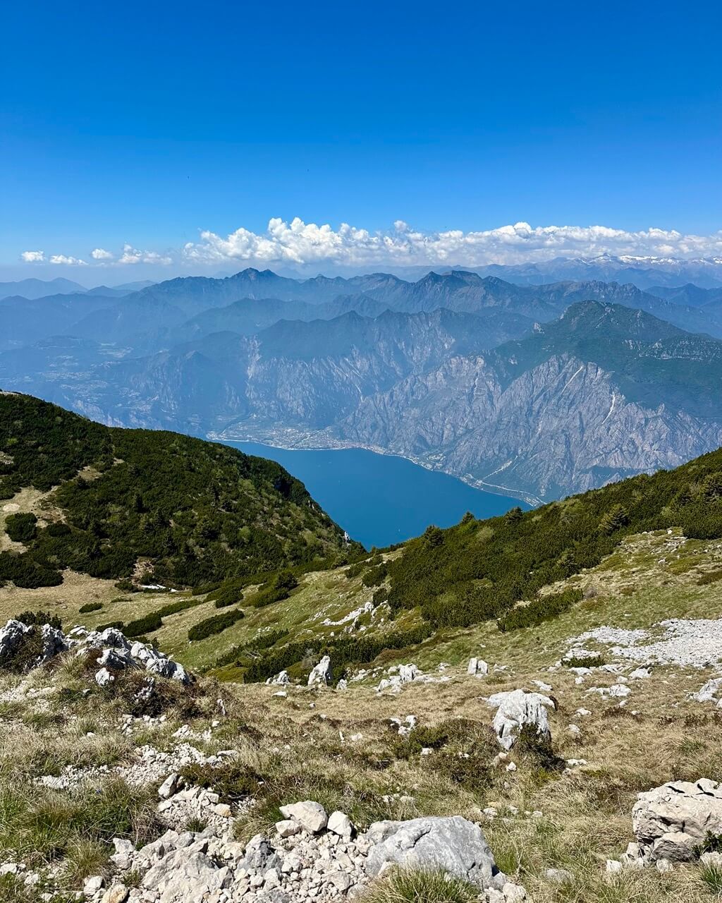
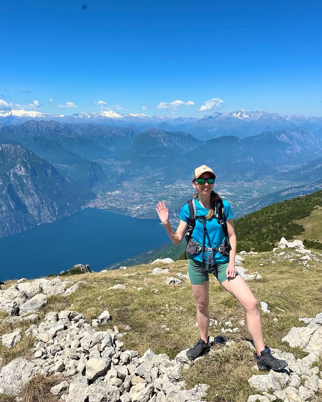
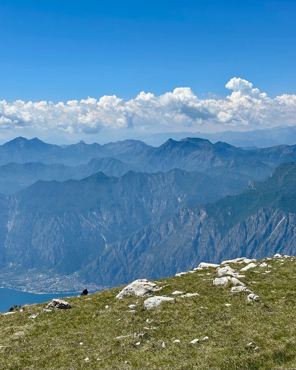
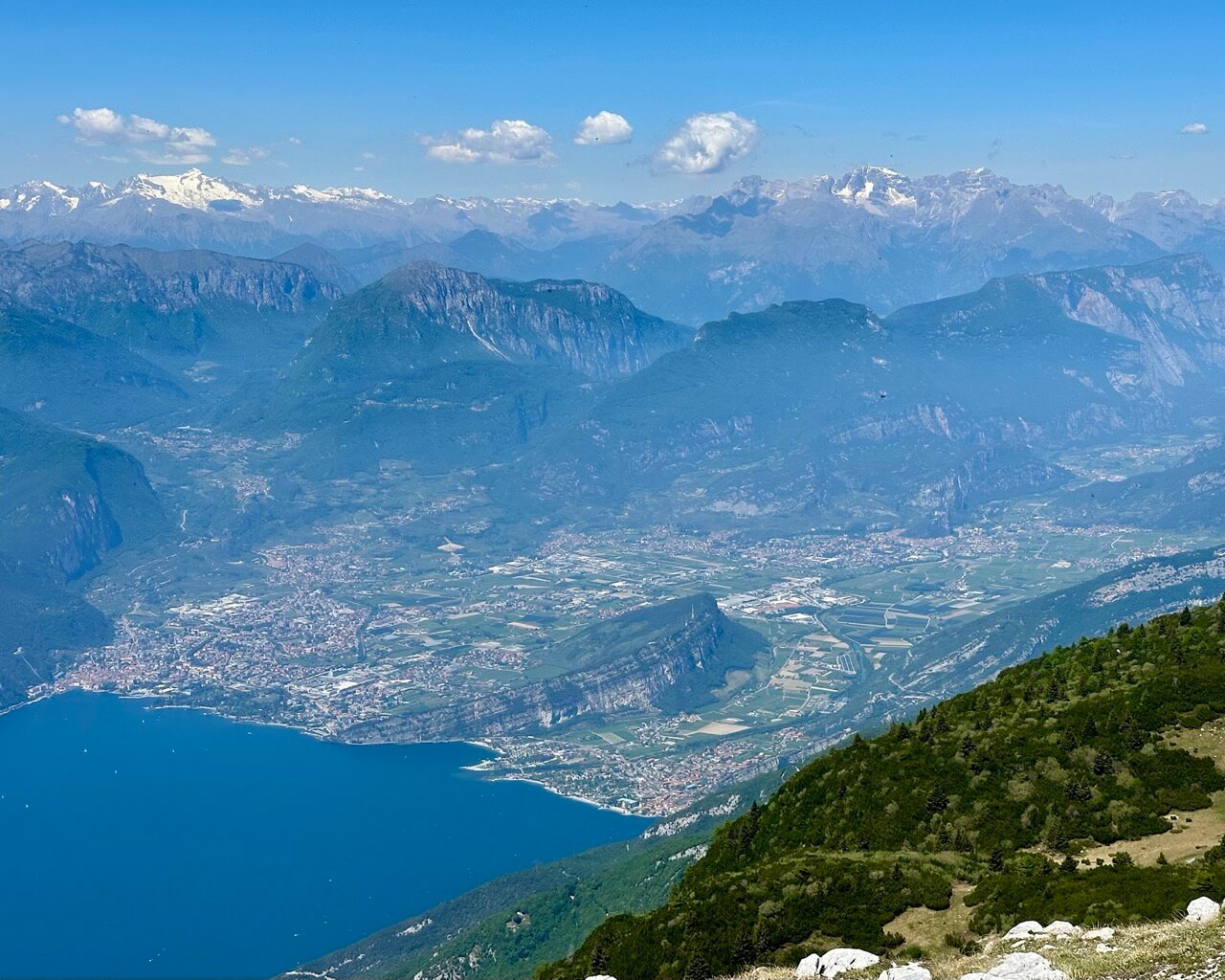
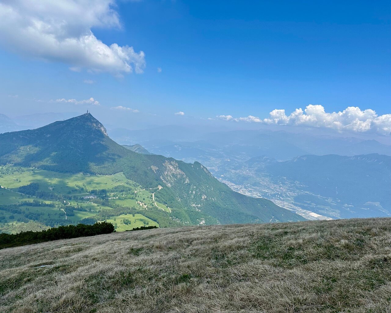
This hike has perhaps the most stunning view of Lake Garda. It’s one of the highest places from which you can see the lake from land.
Monte Altissimo is part of the Monte Baldo mountain range. Unfortunately, this hike isn’t really suitable without a car. The closest bus stop is in the village of San Giacomo, which is nearly two hours away on foot, so you’d have to extend the hike quite a bit.
You’ll start at Bocca del Creer. There’s a free parking lot by Rifugio Graziani, and once it gets full, cars often park along the road too. It’s best to arrive early so you can secure a good spot.
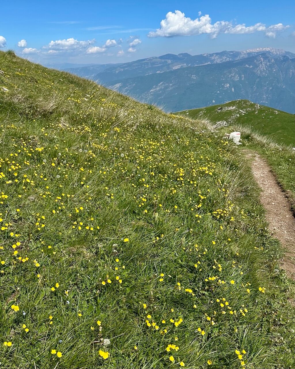
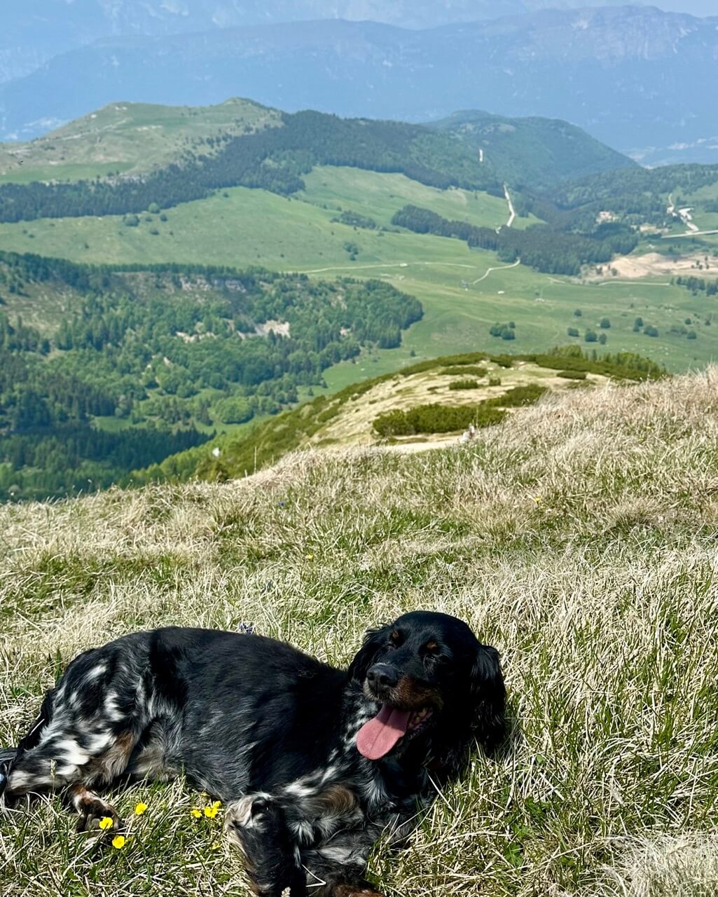
From there, it’s pretty much just up, following trail no. 633. Pace yourself and walk slowly, passing several places that already offer beautiful views. While huffing and puffing up the hill here, I was positively surprised by how many people were hiking with their dogs.
You’ll get most of your altitude gain on the zigzag part that crosses the steepest hillside. Remember that you’ll be hiking in open terrain, so it can get hot.
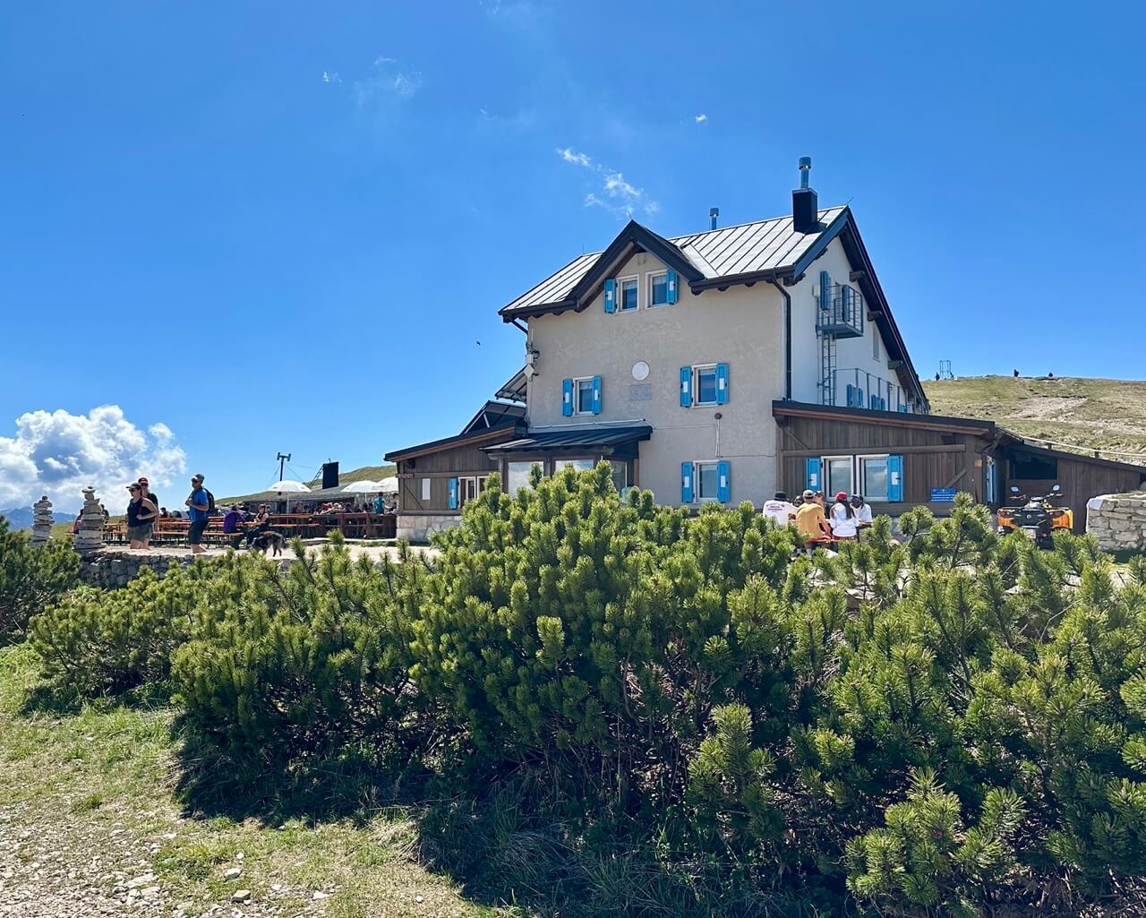
Once at the top, you can reward yourself with a delicious meal at Rifugio Altissimo. Or, if you prefer, go check out the views of Lake Garda first. They’re hiding just behind the Altissimo peak.
In any case, these are your two main rest stops. Rifugio Altissimo, also called Rifugio Damiano Chiesa, is great, and they’re pretty fast with serving food. I had a lovely soup and a radler here, later followed by a macchiato. Sometimes they post their menu on their website.
At the viewpoint, I recommend sitting down for a bit and taking it all in. The northern side of Lake Garda spreads out beautifully below you, with the town of Riva del Garda at its northern end and the unique moon-shaped rock of Monte Brione cutting into it.
If you look to your right, you can see how the ancient glacier once moved toward the lake and created the valley.
If you have extra time and feel like exploring, you can also check out the chapel and several World War II remnants, including bunkers, to the right side of the hut.
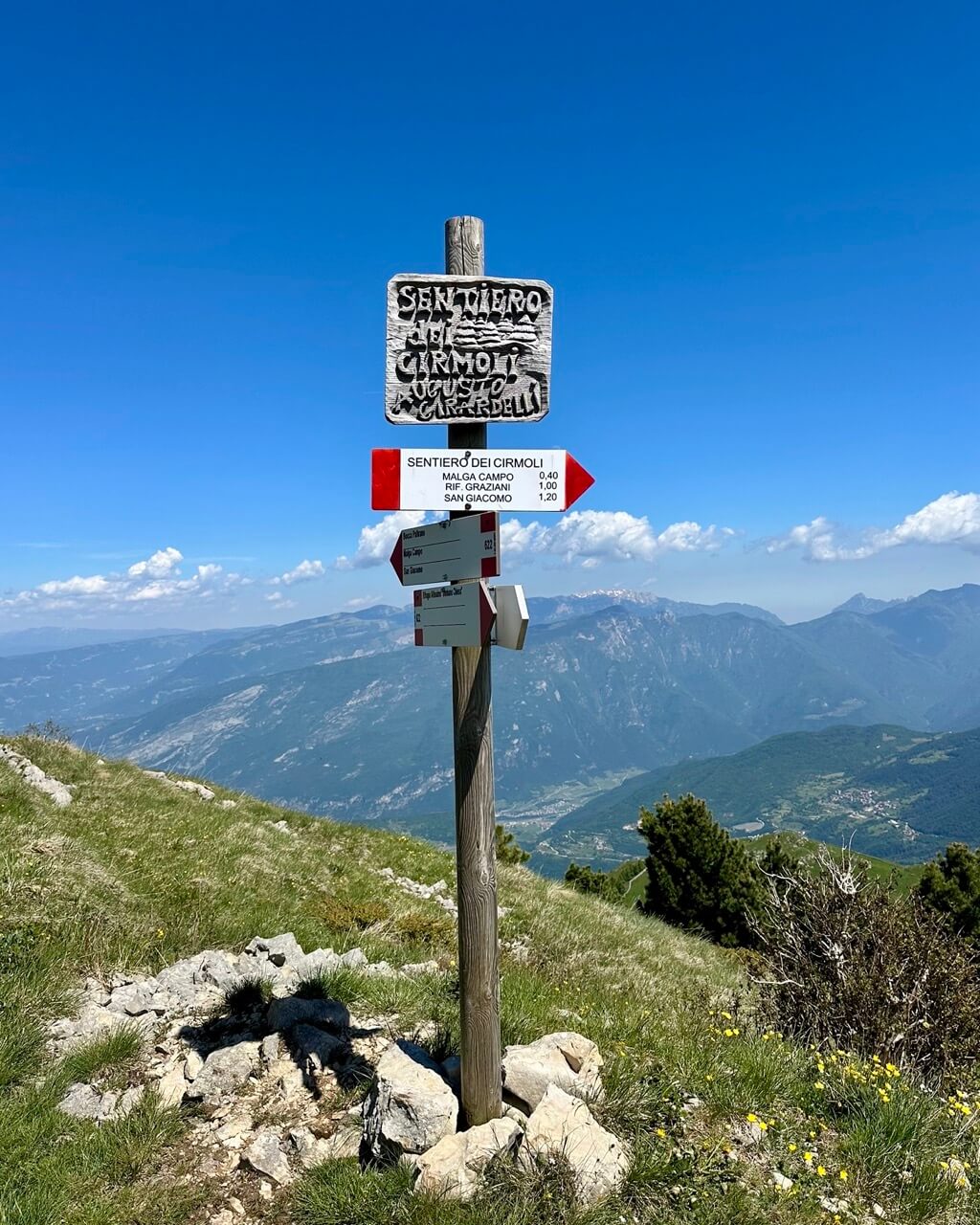
After you’re done feasting your eyes and your stomach, it’s time to hike down. We’re taking a different route to keep things interesting. Continue past the hut on trail no. 622, which is quite steep at first but nothing to worry about.
Once you reach a signpost, turn right away from trail no. 622, and do the same again at the next one. You’ll then walk on a nice, mostly flat, long path numbered 650 all the way to Rifugio Graziani and the parking lot at Bocca del Creer.
Canale di Tenno – Rifugio di San Pietro – Lago di Tenno
Type of hike: Round trip (same way up and down)
Difficulty level: Easy to moderate
Duration: 4 hours
Altitude gain: 400 meters / 1,312 feet
Distance: 9 kilometers / 5.6 miles
Highest point: Rifugio di San Pietro 976 meters / 3,202 feet
Start and end point: Canale di Tenno
Best for: Great food, beautiful medieval vibes and chilling by a turquoise lake
Okay, this hike is of a different kind. It’s north of Lake Garda and features a different lake altogether.
You’ll explore a beautiful medieval village, walk through a forest to a mountain hut with great food, summer season only, and end at a magnificent turquoise lake that’s great for swimming too. So don’t forget to bring a swimsuit!
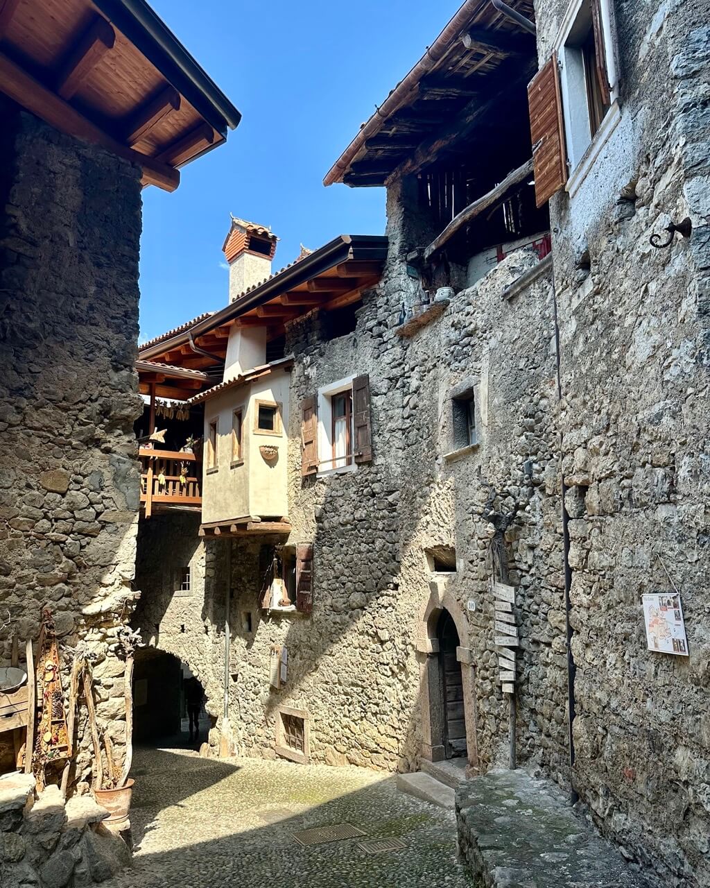
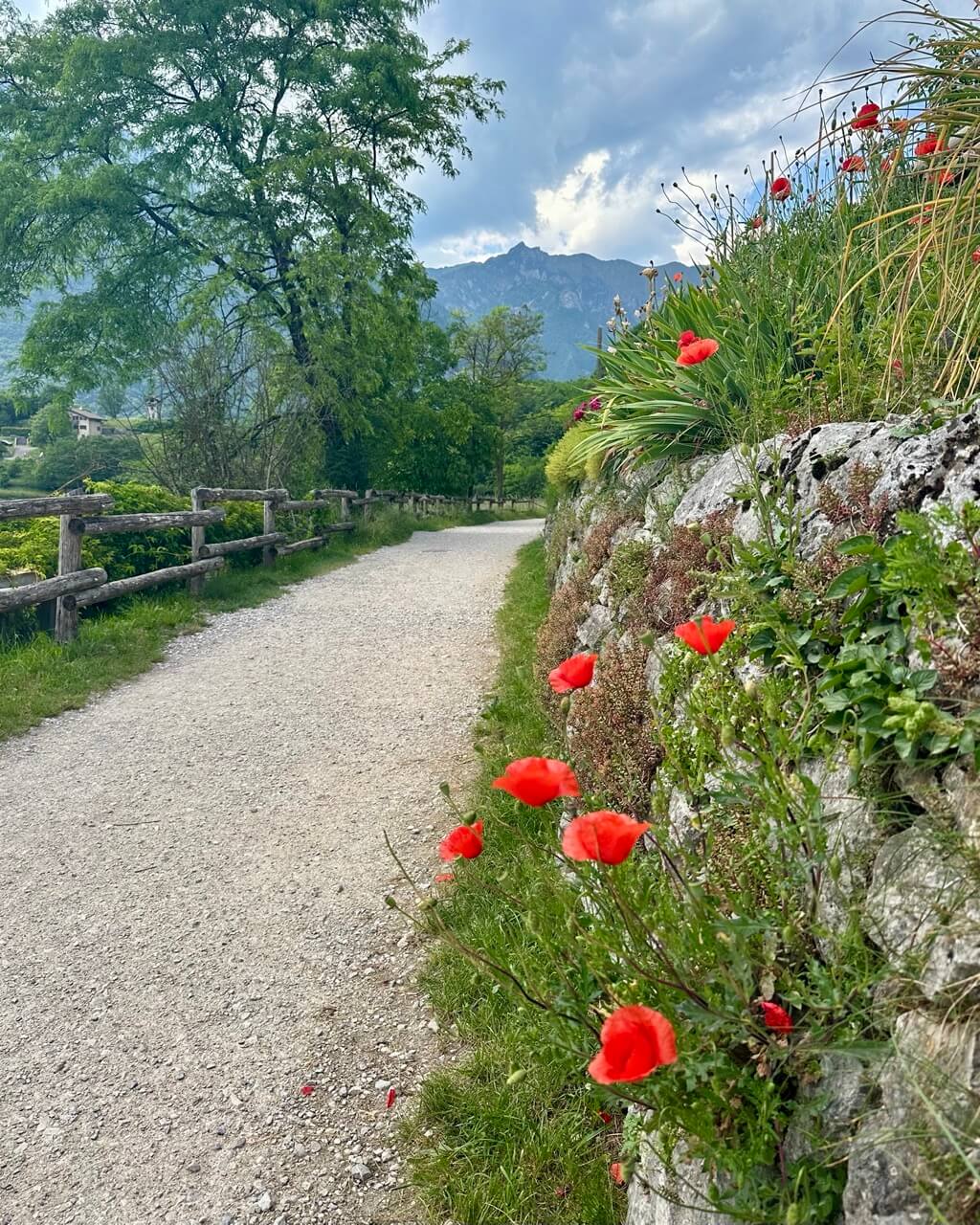
You can adjust this hike based on your preferences. I suggest you start in Canale, or more precisely, the medieval settlement of Canale di Tenno. There are parking lots just below the village.
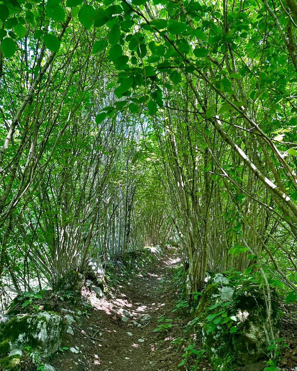
From there, follow forest trail no. 406 up to Rifugio di San Pietro, a mountain hut with a small church right next to it. On the way, you’ll pass the Bastiani signpost.
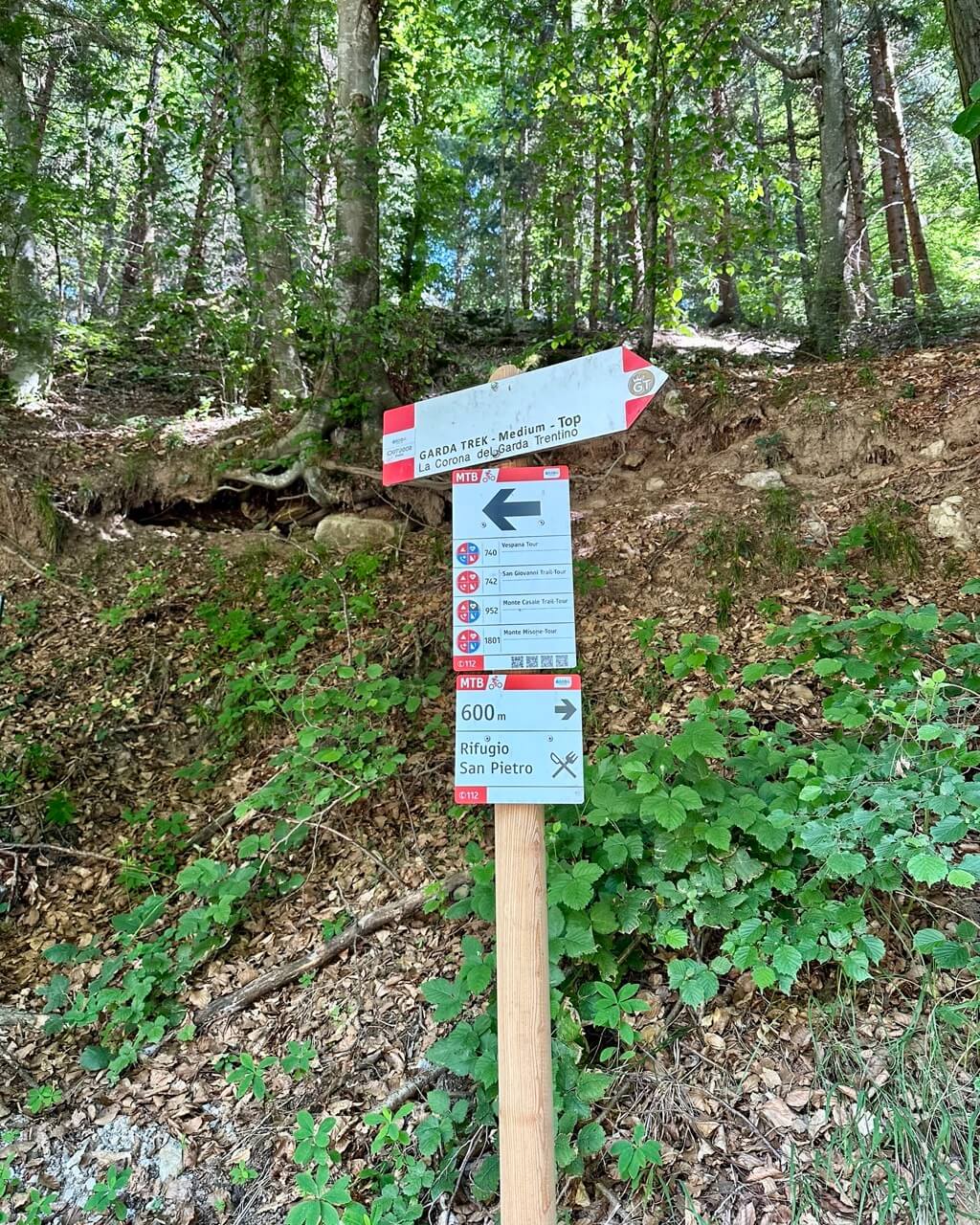
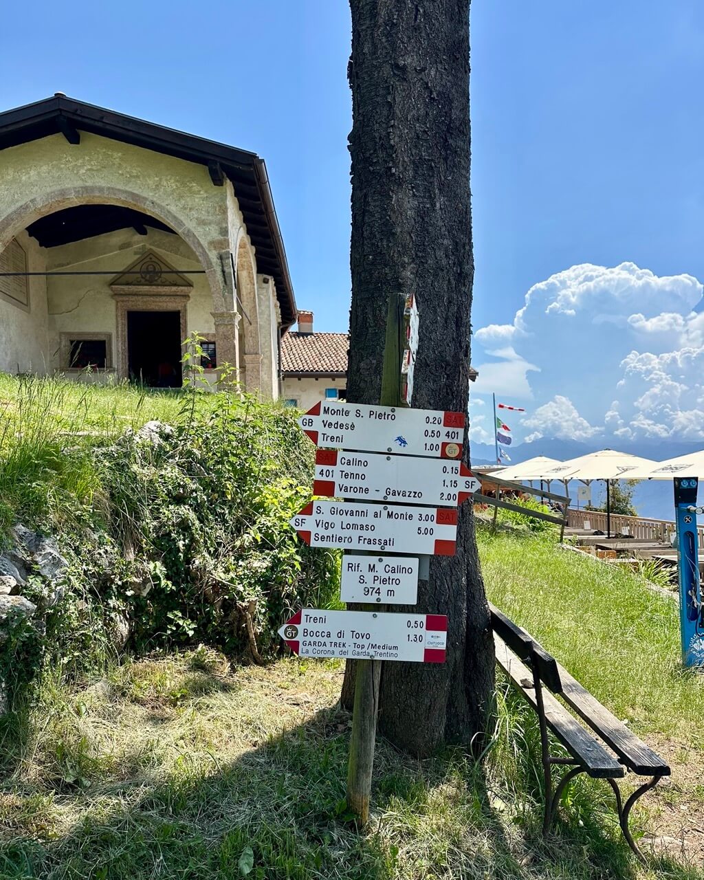
Rifugio di San Pietro usually opens in June and stays open for the summer season. You can check the current info on its official website.
Not only are there amazing views of Lake Garda from the hut, but you can also expect delicious local meals.
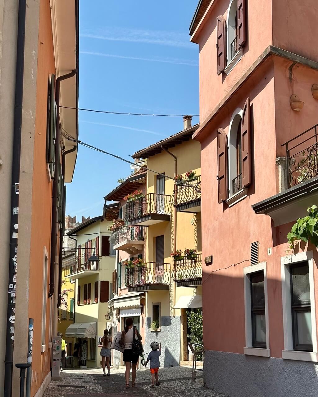
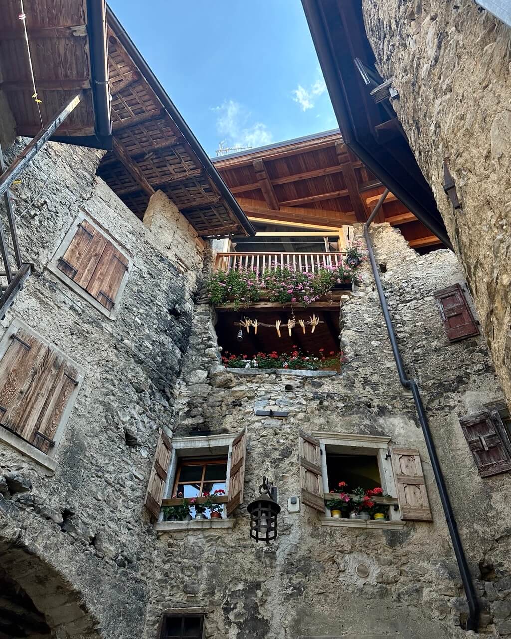
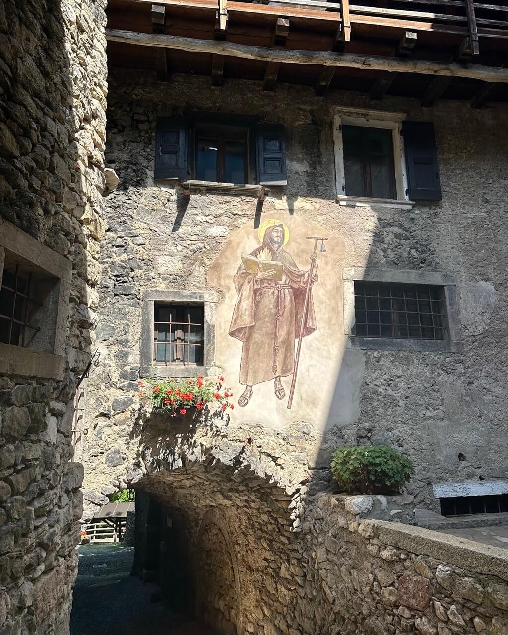
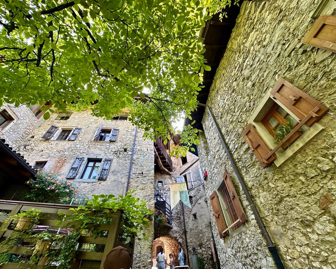
Take the same path, trail no. 406, back to Canale and stroll through its incredibly beautiful alleys. This medieval settlement looks like a movie set, but it’s real and still home to local residents.
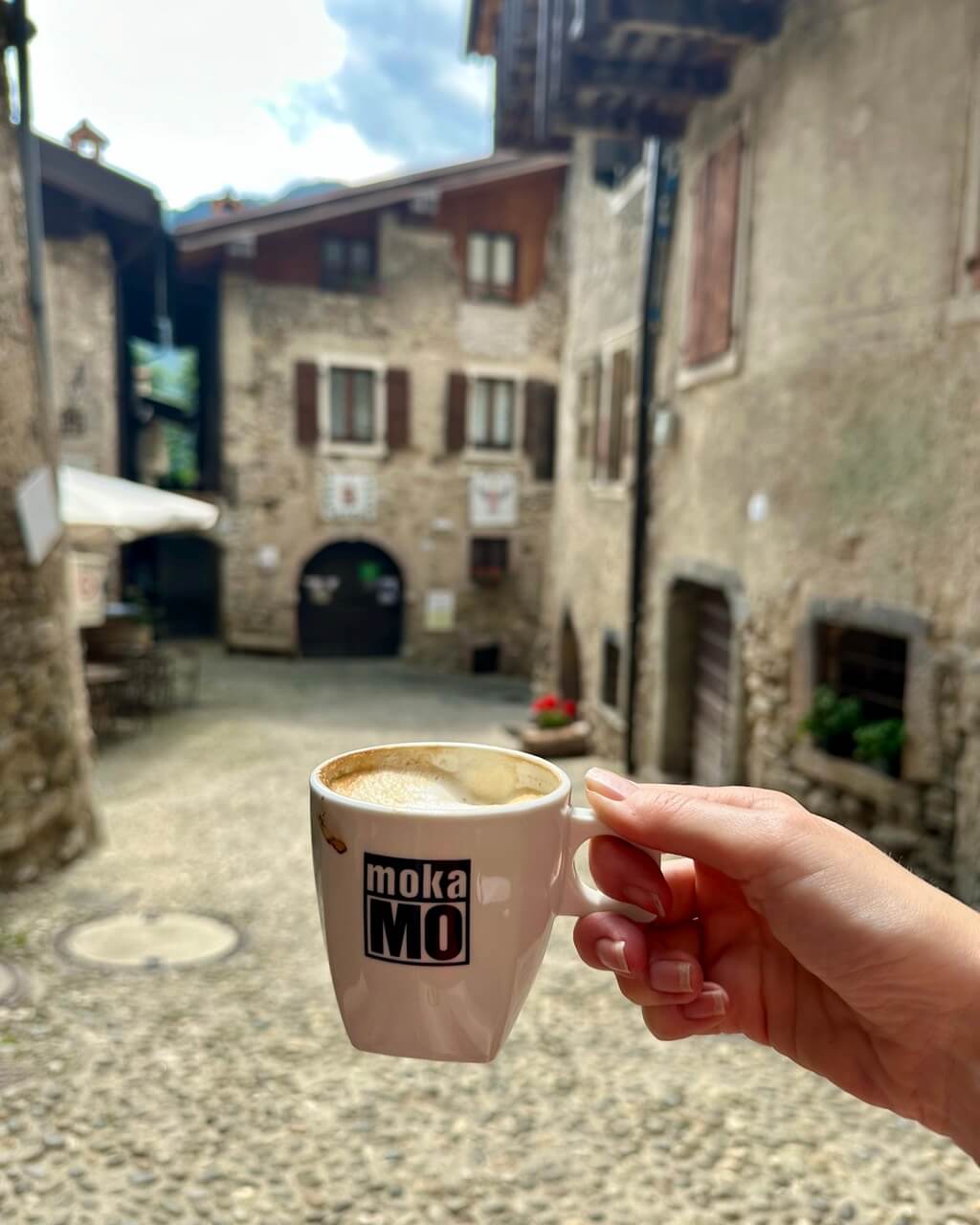
Grab a coffee (or beer) at Taverna Bianca, and once you’ve taken it all in, continue on your way. Ideally, do so with a gelato in hand from the same little restaurant, store, and coffee shop combo.
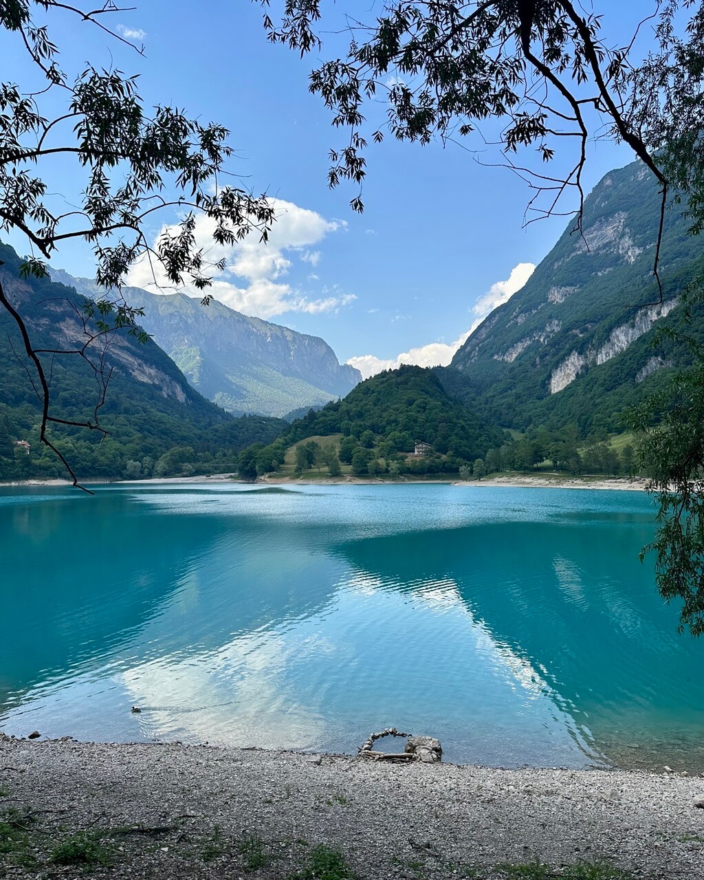
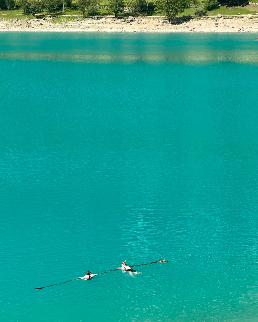
Now it’s time to follow road 406 to Lake Tenno, or Lago di Tenno. Don’t compare this lake to Garda, though. It’s completely different.
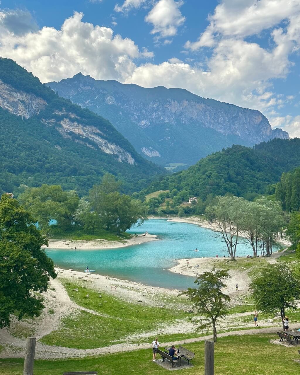
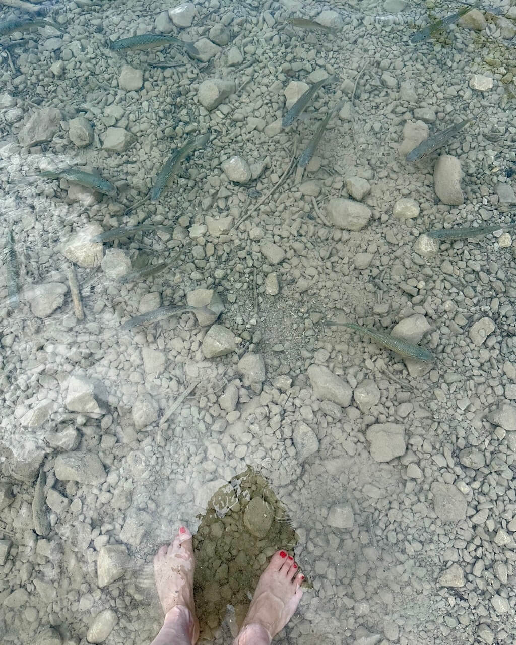
Lago di Tenno is much smaller and has incredible shades of turquoise. It’s clean, beautiful, and you may even meet a few friendly fish. The water temperature may not be for everyone, but I got halfway in even on a cloudy day, so I’d say it’s doable for almost anyone. :)
From Lago di Tenno, make your way back to Canale and to your car.
If you’re taking a local bus, you could start in Canale and finish by Lake Tenno, as there are bus stops in both places. They’re connected by bus line B211, which starts in Riva del Garda.
Near Canale, the bus stop is called Villa S. Antonio in Ville del Monte. For Lake Tenno, use the Lago di Tenno bus stop. You can check departure times on the Garda Trentino local bus timetable.
Three Peaks – Monte Bondone (Monte Cornetto)
Type of hike: Circular
Difficulty level: Advanced
Duration: 6–7 hours
Altitude gain: 750 meters / 2,461 feet
Distance: 12 kilometers / 7.5 miles
Highest point: Monte Cornetto 2,178 meters / 7,146 feet
Start and end point: Parking lot Strada delle Caserme (near Strada delle Viote) 46.0207025N, 11.0427308E
Best for: Incredible mountain views and a challenging but rewarding all-day hike
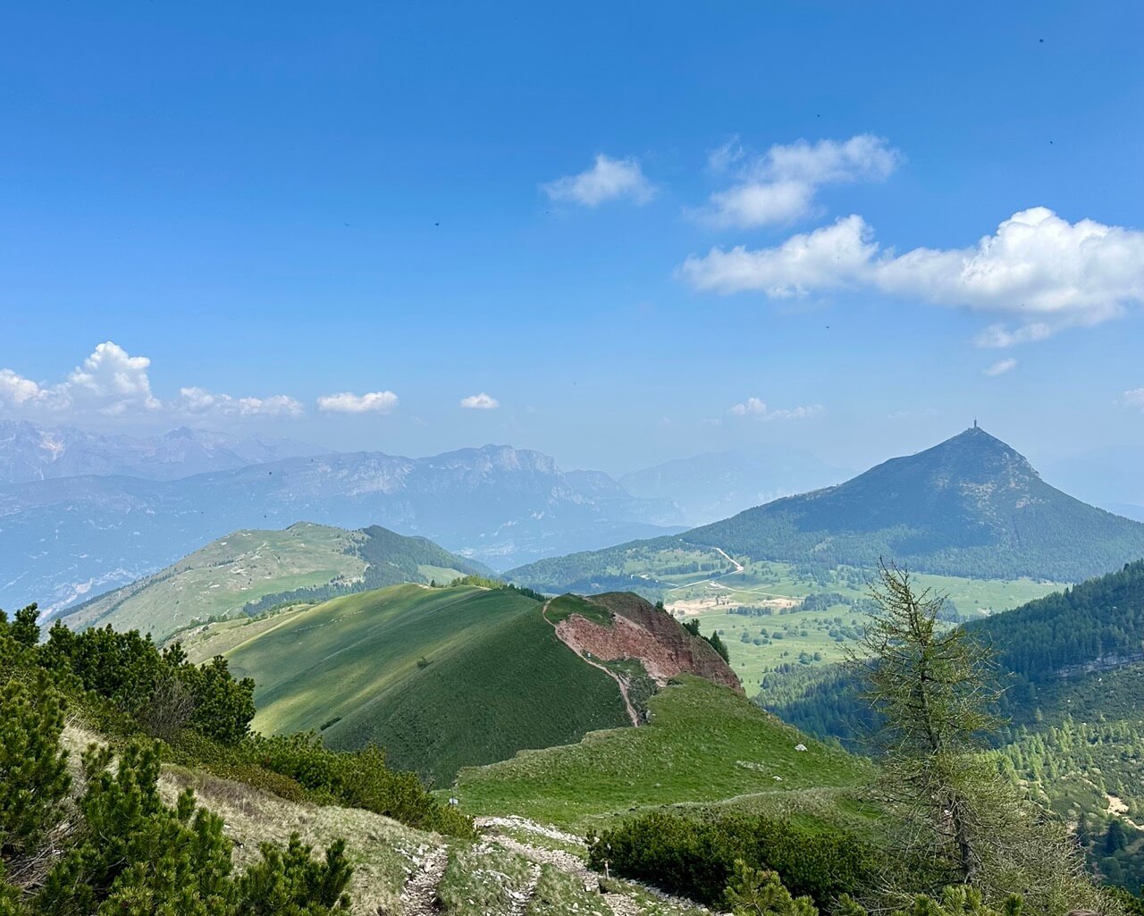
Well, this mountain is located closer to Trento than to Lake Garda, but it’s so, so beautiful that I have to include it here. And it’s still quick to get there from the northern part of Lake Garda, where you’re hopefully staying.
This trek includes three peaks. You’ll climb two of them and pass just below the third. It’s a lovely little mountain trio in an especially beautiful part of the Garda Mountains. Well, you’ll see.
Already from the parking lot, you’ll see an astronomical observatory with a large silver dome. Walk toward it and follow trail no. 607, passing the Costa dei Cavai signpost.

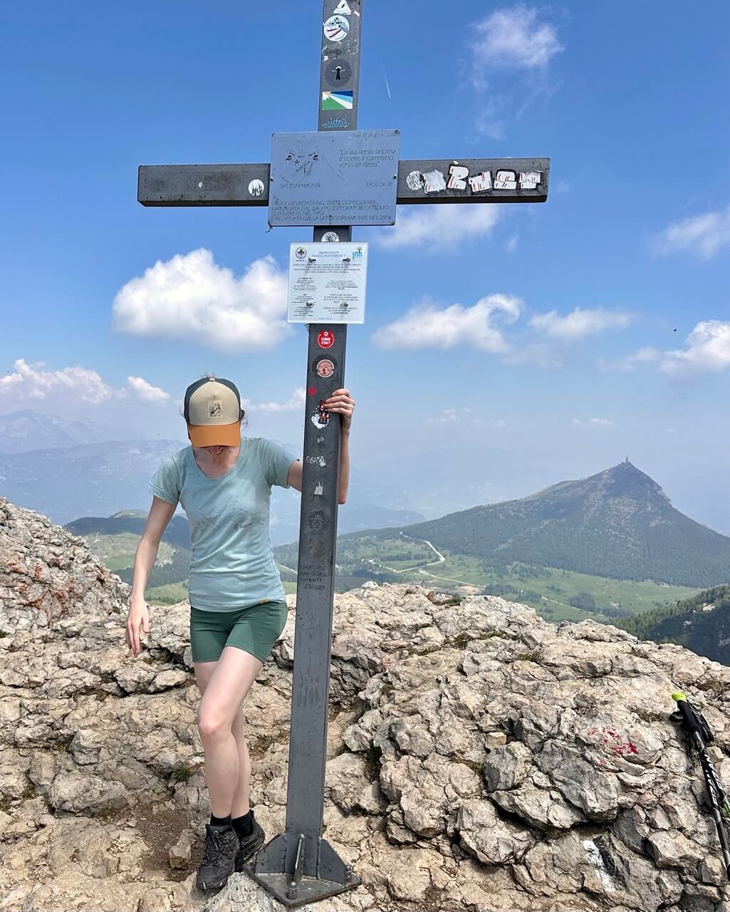
Trail no. 607 leads all the way to Monte Bondone, also known as Monte Cornetto. These two names are often used interchangeably for the highest peak. Right below the actual peak, you can relax and even leave your things for a bit. The very top is rather rocky, but doable.
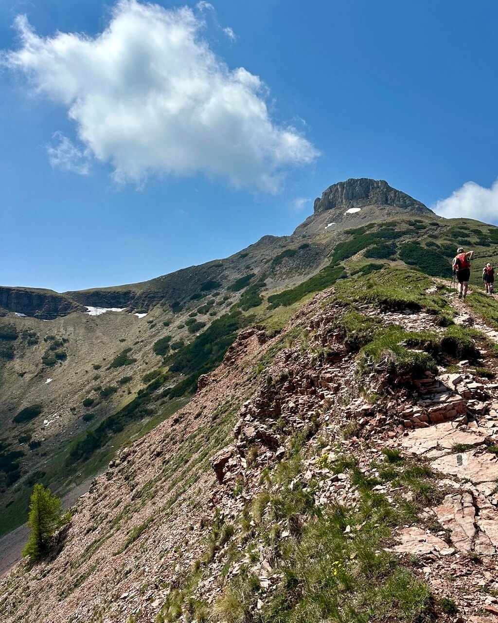
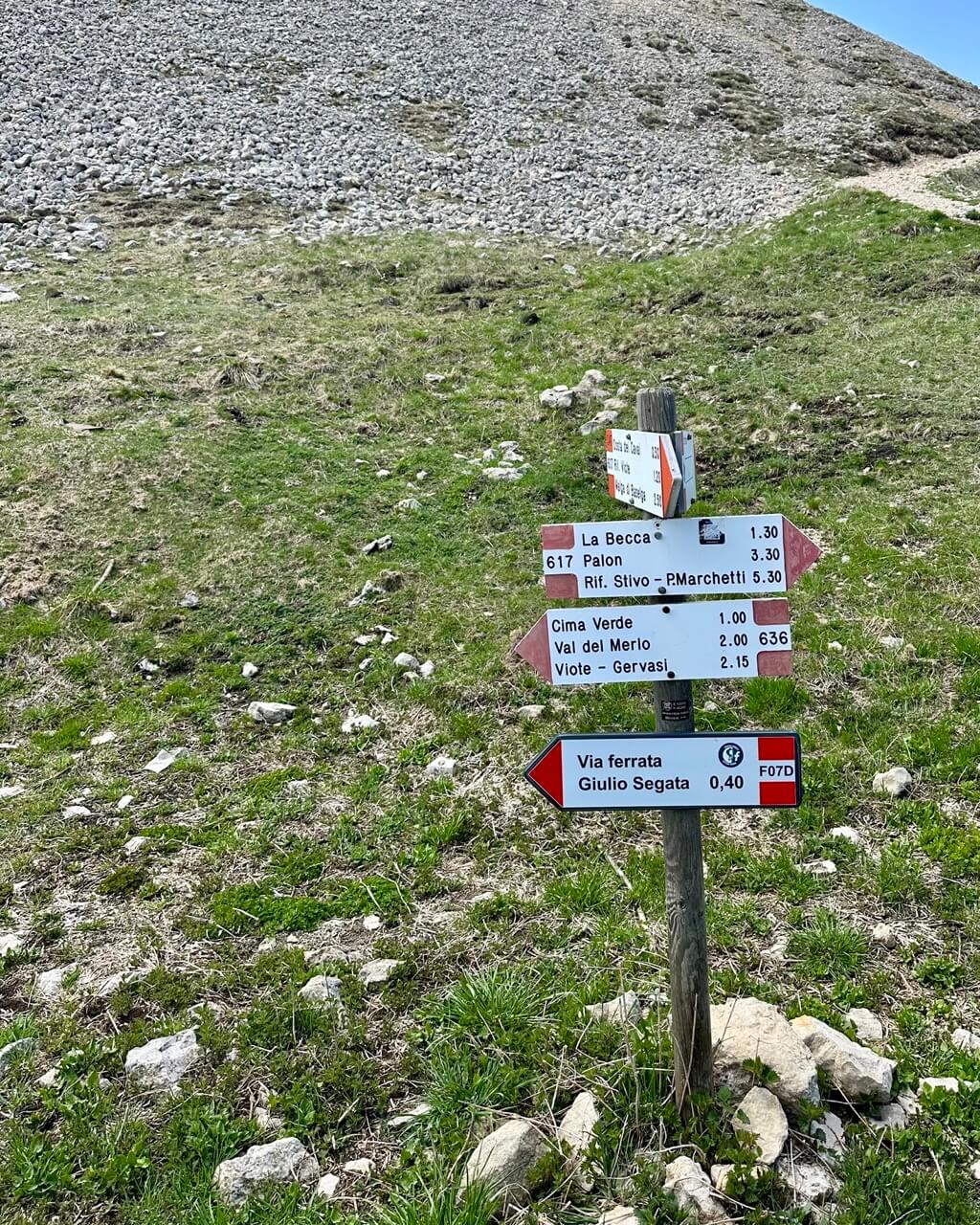
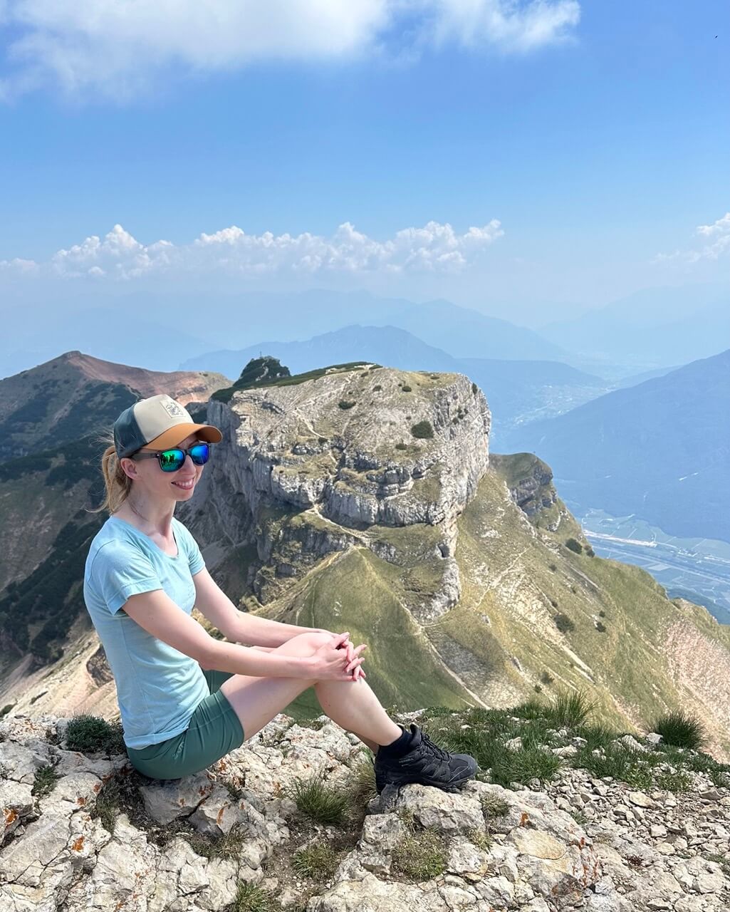
Below Monte Cornetto, you’ll continue on trail no. 636 toward Dos d’Abramo, at 2,140 meters / 7,021 feet. You won’t climb this one, as it’s only accessible via a via ferrata. But don’t worry. The peak is most beautiful when viewed from the trail and from Monte Cornetto anyway. These views were the highlights for me.
Dos d’Abramo will be on your right as you walk just below it, continuing on trail no. 636 to the last peak, Cima Verde, at 2,102 meters / 6,896 feet. This one is pretty from afar too. It looks smooth and almost mossy. You will climb this one, and yes, it offers beautiful views too.
Hopefully, you won’t encounter a lost dog like we did on this peak. But we also witnessed the incredibly touching reunion with his owner, so all ended well. So sweet!
From there, it’s only down. You’ll be climbing down through rocky terrain, mostly covered by trees. Follow trail no. 636 until it turns into 636A. That one then connects back to trail no. 607, which leads past the observatory dome and all the way back to the parking lot.
Phew!
If you need to use a public bus, use the Viote Golfo bus stop on line B202, which connects Trento and Monte Bondone. To get here from Lake Garda, you need to transfer in Trento. Trento is connected with Riva del Garda and Arco by bus no. 205. So, unfortunately, getting to Monte Bondone by public transport is not too convenient, and one way (by bus) would take about 2.5 hours.
Which Lake Garda Hike Should You Choose?
If you only have time for one Lago di Garda hike, here’s how I’d choose:
Easiest hike: Canale di Tenno to Rifugio di San Pietro
Best lake view: Monte Altissimo di Nago
Best food stop: Canale di Tenno to Rifugio di San Pietro
Best full-day challenge: Three Peaks – Monte Bondone (Monte Cornetto)
Best if you don’t have a car: Monte Baldo (Cima delle Pozzette)
And that’s it. I hope these Lake Garda hikes gave you some inspiration and helped you pick at least one trail to add to your trip.
Even if you only do one, it’s so worth seeing Lake Garda from above. The lake is beautiful from the shore, but the mountain views make it feel even more special.
If you’d like to go hiking but prefer having everything arranged for you, check the current hiking tours in the Lake Garda area on GetYourGuide.